SEISMOLOGY AND GEOLOGY ›› 2024, Vol. 46 ›› Issue (3): 536-546.DOI: 10.3969/j.issn.0253-4967.2024.03.002
• Research paper • Previous Articles Next Articles
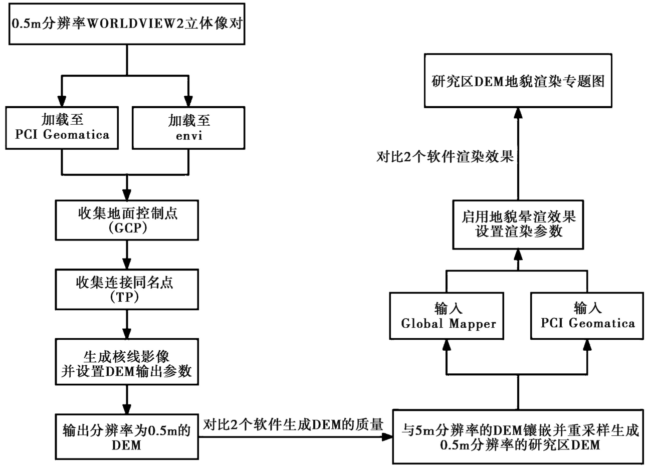
APPLICATION OF HIGH-RESOLUTION DIGITAL ELEVATION MODEL ON HEIKONGSHAN VOLCANO OF TENGCHONG VOLCANIC FIELD IN YUNNAN PROVINCE
WANG Xin-ru1)( ), MA Chen-yu2), PAN Mao1)
- 1) School of Earth and Space Sciences, Peking University, Beijing 100871, China
2) Institute of Geology, China Earthquake Administration, Beijing 100029, China
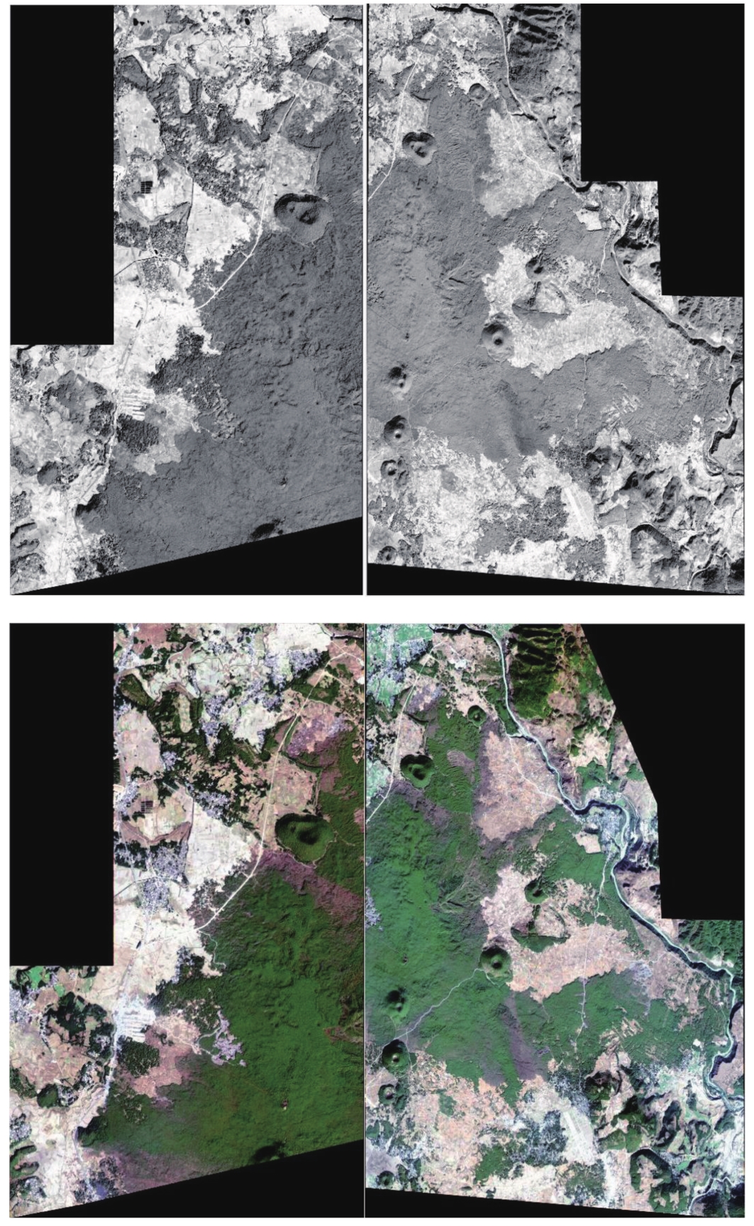
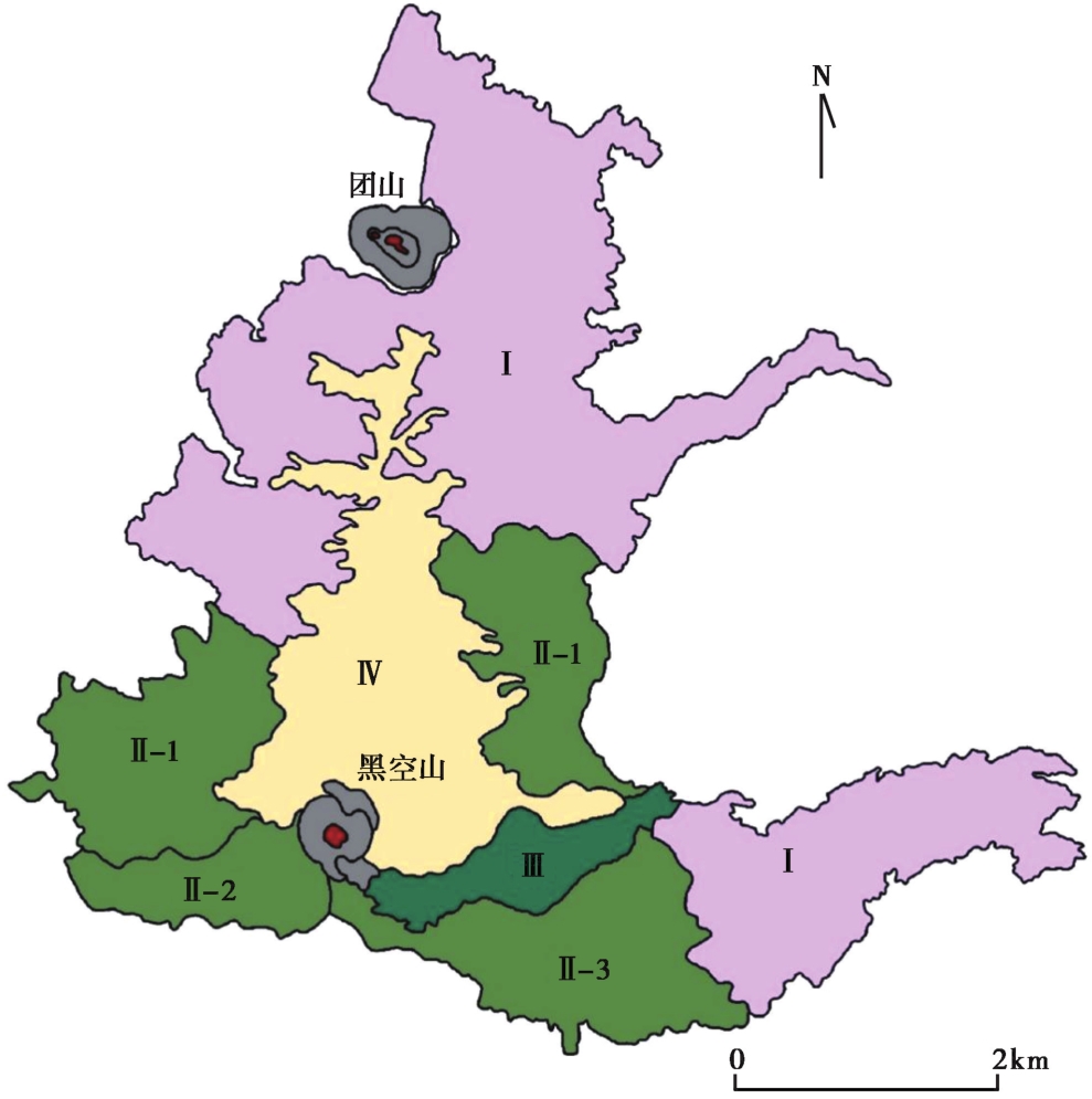
云南腾冲黑空山火山喷发物地貌DEM遥感研究
王新茹1)(), 马晨语2), 潘懋1)
- 1) 北京大学, 地球与空间科学学院, 北京 100871
2) 中国地震局地质研究所, 北京 100029